Lötschberg-Bergstrecke – Wikipedia
| Lötschberg-Bergstrecke | |||||||||||||||||||||||||||||||||||||||||||||||||||||||||||||||||||||||||||||||||||||||||||||||||||||||||||||||||||||||||||||||||||||||||||||||||||||||||||||||||||||||||||||||||||||||||||||||||||||||||||||||||||||||||||||||||||||||||||||||||||||||||||||||||||||||||||||||||||||||||||||||||||||||||||||||||||||||||||||||||||||||||||||||||||||||||||||||||||||||||||||||||||||||||||||||||||||||||||||||||||||||||||||||||
|---|---|---|---|---|---|---|---|---|---|---|---|---|---|---|---|---|---|---|---|---|---|---|---|---|---|---|---|---|---|---|---|---|---|---|---|---|---|---|---|---|---|---|---|---|---|---|---|---|---|---|---|---|---|---|---|---|---|---|---|---|---|---|---|---|---|---|---|---|---|---|---|---|---|---|---|---|---|---|---|---|---|---|---|---|---|---|---|---|---|---|---|---|---|---|---|---|---|---|---|---|---|---|---|---|---|---|---|---|---|---|---|---|---|---|---|---|---|---|---|---|---|---|---|---|---|---|---|---|---|---|---|---|---|---|---|---|---|---|---|---|---|---|---|---|---|---|---|---|---|---|---|---|---|---|---|---|---|---|---|---|---|---|---|---|---|---|---|---|---|---|---|---|---|---|---|---|---|---|---|---|---|---|---|---|---|---|---|---|---|---|---|---|---|---|---|---|---|---|---|---|---|---|---|---|---|---|---|---|---|---|---|---|---|---|---|---|---|---|---|---|---|---|---|---|---|---|---|---|---|---|---|---|---|---|---|---|---|---|---|---|---|---|---|---|---|---|---|---|---|---|---|---|---|---|---|---|---|---|---|---|---|---|---|---|---|---|---|---|---|---|---|---|---|---|---|---|---|---|---|---|---|---|---|---|---|---|---|---|---|---|---|---|---|---|---|---|---|---|---|---|---|---|---|---|---|---|---|---|---|---|---|---|---|---|---|---|---|---|---|---|---|---|---|---|---|---|---|---|---|---|---|---|---|---|---|---|---|---|---|---|---|---|---|---|---|---|---|---|---|---|---|---|---|---|---|---|---|---|---|---|---|---|---|---|---|---|---|---|---|---|---|---|---|---|---|---|---|---|---|---|---|---|---|---|---|---|---|---|---|---|---|---|---|---|---|---|---|---|---|---|---|---|---|---|---|---|---|---|---|---|---|---|---|---|---|---|---|
| Line number (BAV): | 300 (Spiez – Brig) 301 (Old Hondrichtunnel) 302 (Mittalgrabentunnel II) |
||||||||||||||||||||||||||||||||||||||||||||||||||||||||||||||||||||||||||||||||||||||||||||||||||||||||||||||||||||||||||||||||||||||||||||||||||||||||||||||||||||||||||||||||||||||||||||||||||||||||||||||||||||||||||||||||||||||||||||||||||||||||||||||||||||||||||||||||||||||||||||||||||||||||||||||||||||||||||||||||||||||||||||||||||||||||||||||||||||||||||||||||||||||||||||||||||||||||||||||||||||||||||||||||
| Fahrplanfeld: | 330 (Bus 2007 FPF 300) | ||||||||||||||||||||||||||||||||||||||||||||||||||||||||||||||||||||||||||||||||||||||||||||||||||||||||||||||||||||||||||||||||||||||||||||||||||||||||||||||||||||||||||||||||||||||||||||||||||||||||||||||||||||||||||||||||||||||||||||||||||||||||||||||||||||||||||||||||||||||||||||||||||||||||||||||||||||||||||||||||||||||||||||||||||||||||||||||||||||||||||||||||||||||||||||||||||||||||||||||||||||||||||||||||
| Route length: | 74 km | ||||||||||||||||||||||||||||||||||||||||||||||||||||||||||||||||||||||||||||||||||||||||||||||||||||||||||||||||||||||||||||||||||||||||||||||||||||||||||||||||||||||||||||||||||||||||||||||||||||||||||||||||||||||||||||||||||||||||||||||||||||||||||||||||||||||||||||||||||||||||||||||||||||||||||||||||||||||||||||||||||||||||||||||||||||||||||||||||||||||||||||||||||||||||||||||||||||||||||||||||||||||||||||||||
| Trade distance: | 1435 mm (Normalspur) | ||||||||||||||||||||||||||||||||||||||||||||||||||||||||||||||||||||||||||||||||||||||||||||||||||||||||||||||||||||||||||||||||||||||||||||||||||||||||||||||||||||||||||||||||||||||||||||||||||||||||||||||||||||||||||||||||||||||||||||||||||||||||||||||||||||||||||||||||||||||||||||||||||||||||||||||||||||||||||||||||||||||||||||||||||||||||||||||||||||||||||||||||||||||||||||||||||||||||||||||||||||||||||||||||
| Electricity system: | 15 kv 16,7 hz ~ | ||||||||||||||||||||||||||||||||||||||||||||||||||||||||||||||||||||||||||||||||||||||||||||||||||||||||||||||||||||||||||||||||||||||||||||||||||||||||||||||||||||||||||||||||||||||||||||||||||||||||||||||||||||||||||||||||||||||||||||||||||||||||||||||||||||||||||||||||||||||||||||||||||||||||||||||||||||||||||||||||||||||||||||||||||||||||||||||||||||||||||||||||||||||||||||||||||||||||||||||||||||||||||||||||
| Maximum inclination: | 27.6 ‰ | ||||||||||||||||||||||||||||||||||||||||||||||||||||||||||||||||||||||||||||||||||||||||||||||||||||||||||||||||||||||||||||||||||||||||||||||||||||||||||||||||||||||||||||||||||||||||||||||||||||||||||||||||||||||||||||||||||||||||||||||||||||||||||||||||||||||||||||||||||||||||||||||||||||||||||||||||||||||||||||||||||||||||||||||||||||||||||||||||||||||||||||||||||||||||||||||||||||||||||||||||||||||||||||||||
| Minimal radius: | 220 m | ||||||||||||||||||||||||||||||||||||||||||||||||||||||||||||||||||||||||||||||||||||||||||||||||||||||||||||||||||||||||||||||||||||||||||||||||||||||||||||||||||||||||||||||||||||||||||||||||||||||||||||||||||||||||||||||||||||||||||||||||||||||||||||||||||||||||||||||||||||||||||||||||||||||||||||||||||||||||||||||||||||||||||||||||||||||||||||||||||||||||||||||||||||||||||||||||||||||||||||||||||||||||||||||||
| Spiez – Frutigen – Brig | |||||||||||||||||||||||||||||||||||||||||||||||||||||||||||||||||||||||||||||||||||||||||||||||||||||||||||||||||||||||||||||||||||||||||||||||||||||||||||||||||||||||||||||||||||||||||||||||||||||||||||||||||||||||||||||||||||||||||||||||||||||||||||||||||||||||||||||||||||||||||||||||||||||||||||||||||||||||||||||||||||||||||||||||||||||||||||||||||||||||||||||||||||||||||||||||||||||||||||||||||||||||||||||||||
|
|||||||||||||||||||||||||||||||||||||||||||||||||||||||||||||||||||||||||||||||||||||||||||||||||||||||||||||||||||||||||||||||||||||||||||||||||||||||||||||||||||||||||||||||||||||||||||||||||||||||||||||||||||||||||||||||||||||||||||||||||||||||||||||||||||||||||||||||||||||||||||||||||||||||||||||||||||||||||||||||||||||||||||||||||||||||||||||||||||||||||||||||||||||||||||||||||||||||||||||||||||||||||||||||||
When Lötschberg-Bergstrecke the Swiss railway line (course book field 330, before opening the basic tunnel 300), is referred to, which connects the Bernese Oberland to the Valais. The heart of the route is the 14,612 meter long Lötschberg tunnel. The route is world famous due to its double loop (tunnel) on the north ramp, its many art buildings and the southern ramp in the Rhone valley under railway enthusiasts.
With the opening of the Lötschberg base tunnel in 2007, it takes up a large part of the traffic between Frutigen and Brig. Since then, the mountain route has only been used by regional express and freight trains that have not received any route through the base tunnel.
The Lötschber route with a mountain route and base tunnel is the second north-south connection through the Swiss Alps in addition to the Gotthard Railway. At the same time, it is considered a feeder of western German -speaking Switzerland, western Germany and eastern France to the Simplonbahn towards Milan in Italy.
The starting point of the Lötschberg route is the railway node Spiez, from there it runs in the north-south direction through the Kandertal via frutigen, where the new base tunnel branches off, and Kandersteg to the Lötschberg tunnel in Goppenstein. From Hochtn it turns down to the south flank of the Bietschhorn massif to Brig in an eastern direction.
The route is 74 kilometers long and a non-stop ride with a timetable SBB intercity train lasted a total of 56 minutes in 2007 (Spiez-Brig).
The Lötschberg route was created as the main line of the former Bern-Lötschberg-Simplon-Bahn (today BLS AG), which in 1906 under the name Bernese Alpenbahngesellschaft Bern – Lötschberg – Simplon was founded for this purpose.
prehistory [ Edit | Edit the source text ]
By building the two railway north-south main transactions Gotthard and Simplon, the canton of Bern was bypassed by the train connections in Germany-Italy.
Idea of a Lötschbergbahn [ Edit | Edit the source text ]
The canton of Bern had to take advantage of all its federal rights to create its own transit railway. Since on the part of the Confederation, due to its financial participation in the Gotthard Railway, no financial help could be expected, Bern had to otherwise procure funds to build its own connection to the south.
In 1891, a small group of well -known personalities received the concession for the construction of a railway line between Spiez and Frutigen with the option of a later extension to the Valais. The old government council and former chief judge Wilhelm Teuscher, the intellectual father of the Lötschbergbahn, came to the opinion in a study that this train could continue to Kandersteg and through a crown tunnel under the Balmhorn massif to Goppenstein. From there, the route could be extended to the north portal of the planned Simplon tunnel thanks to a loan route down into the Rhônetal.
On July 25, 1901, the Spiez-Frutigen-Bahn (SFB) was opened as the first stage of the Lötschberg route.
In addition to this variant by the Lötschberg, the cantonal government planned a second variant, a wild hustle and bustle via Lenk and under the wild hustle and bustle into Valais near Leukerbad.
Thanks to the assertiveness of the Pro Lötschberg Initiative Committee, the lines were finally decided by the Kandertal.
On July 27, 1906, the Bernese Alpenbahn-Gesellschaft Bern-Lötschberg-Simplon (BLS) was founded, which should be responsible for construction and operation.
On January 1, 1907, the BLS took over the Spiez-Frutigen-Bahn, which was serving as an access route.

Smell [ Edit | Edit the source text ]
The entire construction work of the Lötschberg route was the French building consortium Lötschberg company forgive. The start of construction took place on October 15, 1906 with the drilling of the north portal of the Lötschberg tunnel.
The entire mountain route was planned as a full -line rye. The route was carried out single -lane, but a possible double lane was thought of in the track position from the start and the necessary preparatory work such as the foundation was carried out in the buildings and tunnels. The maximum slope was set at 27 ‰ and the minimum curve radius at 300 meters.
For the construction of the route, a construction railway with a track width was created on both sides.
During the construction of the Lötschberg route there were several fatal accidents.
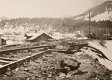
Also worth mentioning is the avalanche passage from February 29, 1908, which took place between 7 a.m. and 8 a.m. Due to the train of the Gmeinlaui, a dust blaw was declined, which the nearby Hotel at the Goppenstein station did not even touch. Nevertheless, the hotel was swept away. In collapsing timber construction, eleven people immediately found death. They did not die of injuries from debris, but suffocated from the sudden air pressure, which was caused by the dust angle; They were all sitting towards avalanche with their face. All those who sit with their backs to the avalanche were injured at most by flying debris. A twelfth person, engineer Sylva, died a few days later from the injuries that a fallen radiator had caused.
On July 24, 1908, a water slump occurred in the Lötschberg tunnel, which cost 25 lives; three workers of this layer survived. In order to avoid further burglaries of water and material, the tunnel that was originally just laid out had to be deviated to tunnel the Kander elsewhere. [first]
On December 4, 1911, engineer Hans Sieber from Worb was fatal when he fell from the pillar II of the Lüegelkinnviaduct. He was the construction manager of the B.L.S. Has Hochtenn for the construction.
On October 10, 1912, part of the incision collapsed at the Viktoria tunnel on the southern ramp and tore the teaching framework. Two fatalities were to be complained.
It was originally planned to open the route on March 1, 1912. However, this date had to be postponed twice due to additional work in connection with the preparatory work for a double track expansion. On July 15, 1913, the route electrified from the beginning was handed over to the operation with a reduced timetable. On September 18, 1913, the definitive timetable with seven continuous trains north-south and nine continuous trains south-north, including four international express trains, was introduced. In addition, individual trains still ran on sections.
![Längsprofil der Lötschbergbahn. Aufgetragen ist die Höhe in [m] auf der Projektion der Strecke in die Ebene in [km].](https://upload.wikimedia.org/wikipedia/commons/thumb/8/84/LongitudinalProfileLoetschbergbahnSwitzerland_woCaptions.jpg/220px-LongitudinalProfileLoetschbergbahnSwitzerland_woCaptions.jpg)
Tunnels [ Edit | Edit the source text ]
The ramp tunnels’ patties took place as follows.
North side
- Riedschuktunnel,
- Felsenburgtunnel II, December 28, 1910
- Ronenwaldtunnel I, 15. September 1910
- Ronenwaldtunnel II, 30. September 1910
- Rotbachtunnel, 9. September 1910
- Secret Tunnel, November 10, 1910
South side
- Rotlauitunnel, 3. April 1908 first
- Mittalgrabentunnel, March 29, 1908 first
- Learje tunnel, 5. April 1908 first
- Hoheggtunnel, 30. November 1907 first
- Marchgrabentunnel, 13. Dezember 1907 first
- Hochtentunnel, March 10, 1908 first
- Lidenplate tunnel, September 30, 1907 first
- Blasbodentunnel, February 6, 1908 first
- Sevistein tunnel I, March 17, 1908 first
- Mahnkinnunnel, March 29, 1908 first
- Dornentunnel, March 11, 1908 first
- Victorial Tunnel, November 5, 1907 first
- Mundbachtunnel, September 28, 1907 first
- Stadeltunnel, November 25, 1910
- Schluchitunnel, April 8, 1911
- Bietschtal tunnel I, August 29, 1911
- Bietschtal tunnel II, February 21, 1911
- Sevistein tunnel II, December 30, 1911
- Foundation Runnel, March 11, 1911
- Eggerbergtunnel, 24. März 1911
- Bathing tunnel, 31. März 1911
- Sevisteintunel III, 25. October 1915 2
Construction [ Edit | Edit the source text ]
For the construction of the Lötschberg route and the Lötschberg tunnel, two temporary construction paths were operated on the north and southern ramp for personnel and material transport. These developed the portals of the Lötschberg tunnel in the canton of Bern on the north side and of Naters in the canton of Valais on the south side. The lane of the construction strains operated with steam locomotives was 750 mm. The maximum slope 60 ‰ on the north side and 30 ‰ on the south side; With a minimum curve radius of 50 m. While an independent lines were chosen on the north side for the company, it follows the future railway line to a large extent on the south side.
The height hiking trail created by the BLS is reminiscent of the Baubahn along the southern ramp. This follows on longer sections of the former route of the Baubahn, especially in the Bietsch and Baltschiedertal. A Baubahn steam locomotive set up at the Kandersteg train station also reminds of the Baubahn.
North side [ Edit | Edit the source text ]

The Baubahn built by engineer J. Seeberger between Frutigen and the tunnel north portal near Kandersteg had a length of over 15 kilometers and overcame 429 meters of altitude.
The substructure of the Baubahn was completed on June 30, 1907 and on August 19, the first steam locomotive came to the portal of the tunnel.
From the Baubahn, countless branches led towards the various construction sites of the future lines of the main railway, including in Kandergrund, Blausee-Mitholz and above the Bühlstutz.
In order to be able to overcome the large gradient between Blausee and Kandersteg, several sweeping loops and daring wooden viaducts had to be created during the so -called Bühlstutz. The most impressive was the Aegertenviaduct with a total length of 126 meters, which also had a slope of 57 ‰ and a curve radius of 50 meters.

South side [ Edit | Edit the source text ]
The construction of the Baubahn on the south side was severely delayed by many objections; The groundbreaking ceremony near Naters took place on February 12, 1907. The lines of the 28 -kilometer -long Baubahn, with an average climb of 30 ‰, almost exactly corresponded to the lines of the planned railway line, only due to time constraints the many side valleys were fully driven and their foothills bypassed. Nevertheless, 34 tunnels with a total length of 5.3 kilometers had to be blown up, of which 13 tunnels could later be used for the main road.
The construction work for the company took longer than expected, since due to the lines on the future route, there were several longer interruptions because there were many company rail tunnels in the tunnel cross -section of the final rail tunnels. In addition, when the cuts were built, smaller slope slide often took place, which the company railway line affected.
In August 1908, almost two years after the outbreak work began on the southern portal of the tunnel, the first material train was able to drive up the entire southern ramp from Naters to Goppenstein. Until then, the entire building material had had to be promoted through the narrow lonza gorge with a mule or with multi -horserable wagons.
Vehicle park and transport performance [ Edit | Edit the source text ]
In addition to 420 cars of 32 small four-damped steam locomotives with movable axles according to system Klien-Lindner, which were delivered by the German company ORENSTEIN & KOPPEL between June and November 1907. The trains reached a top speed of 15 km/h, and the monthly transport quantity was 13,000 tons on average.
expansion [ Edit | Edit the source text ]
In addition to the Lötschberg head tunnel, the route was initially expanded. The bridges and tunnels of the route had been partially designed in two lanes, but were initially not completely expanded or broken out. From 1976 to 1992, the Lötschberg mountain route was completely duplicated. Thanks to lowering of the route, a continuous so-called Sim Corridor (Simplon-Inter-Modal) could be created for the rolling country road (piggyback traffic) and high-cube containers. However, this can only use one of the two tracks on the four sections of Kandergrund-Blausee-Mitholz (right), Blausee-Minholz-Felsenburg (left), Kandersteg-Goppenstein (left) and Rarnerkumme-Ausserberg (right) (indication on the right/left in the direction of travel south). The capacity could also be massively increased for passenger transport.
Since mid-2007, the Lötschberg base tunnel frutigen has been connected with Visp. This means that the first of the two “new railway alpine transversals (NEAT)” is in operation and the old Lötschberg route Frutigen-Brig is used less intensely.
Future [ Edit | Edit the source text ]
The new base tunnel has deducted almost all of the long-distance transport and a handsome part of freight transport from the previous route through the Lötschberg-Scheitelt tunnel, but it continues to run hourly regio express trains between Bern or Spiez and Brig as well as freight trains via the mountain range.
In addition, the subsidized by the federal government until 1998 [3] Auto-packed between Kandersteg and Goppenstein and replaces the motorway tunnel of the Nationalstrasse under the Rawil Pass in the 1970s and never built.
On November 16, 1931, the pull rope of a elevator winch with the driving line came into contact with the driving line when building protective walls against rockfall and avalanches near Goppenstein, with four workers being killed by the electric shock. [4]
On December 19, 1947, the explosion of a ammunition camp at the Blausee-Mitholz station called for nine dead, including two train workers. [5]
On January 7, 1958, the high -speed high train ran uphill at around 6:10 p.m. on a rock bar slid onto the track. The AE 4/4 253 and the Z4i 830 at the top of the train derailed. The locomotive drove down the slope for about 90 meters without overcutting. The postal car overturned several times and collected down into the river bed of the Rotten. The train driver and the two post officials were slightly injured. The postal car built in 1950 was canceled on the spot on January 20. The locomotive was pulled up to the track on March 21, 1958 in an elaborate campaign and brought to repair. [6]
On February 2, 1978, the express train drove 385 Brig – Bern into an avalanche that had gone off in the valley of the Jolibach and had largely buried the exit of the Blasse Bodentunnel. The leading locomotive RE 4/4 No. 183 derailed and fell from the ijollibach bridge [7] in the valley. The three following cars also derailed, which bent and lying on the bridge in the crashed position on the locomotive. The locomotive driver and at least one passenger were injured. [8]
On May 17, 2006, an office withdrawal with non -functioning brakes released and, after an uncontrolled journey at Dürrenast, bounced on the track. Three employees were killed on the train. In order to avoid even greater damage, the duty was led to a construction train in front of Thun. [9]
Infrastructure [ Edit | Edit the source text ]
The infrastructure of the entire route, apart from the area of the Brig station, belongs to BLS Netz AG.
Train operation [ Edit | Edit the source text ]
The concessions for the regional trains (“Lötschberger”) including RegioExpress on the entire route as well as the car transport trains between Kandersteg and Goppenstein or Iselle are at BLS AG.
Long -distance traffic is completely covered by SBB.
Ausfahrtlück Spiez – Frutigen [ Edit | Edit the source text ]
The Spiez train station is at a height of 628 m ü. M. And is the starting point (km 0) of the route kilometer of the Lötschberg route.
The arrival route from Spiez to Frutigen is evenly designed with a slope of 15 ‰.
The route first leads through the Hondlichtunnel extended to 1709 m in 1986. Below the Kander to the former Heustrich-Emdthal intersection station (km 5.1) 678 m ü. M. which is no longer served by the trains. At km 6.8 the Mülenen station follows ( 692 m ü. M. ), where the valley station of the Niesen stand cable car is located right next to the train station, which is up to the 2362 m ü. M. High sneezing drives.
Further along the Kander follows at KM 8.2 the village of Reichenbach in the Kandertal ( 706 m ü. M. ) Behind Reichenbach crosses the Kander and reaches the frutigtal extensive. At the former Wengi stop, the route was moved to the east in 2005/2006 and is connected to a single-lane, underground access route to the Lötschberg-Basistunnel, which goes through the Frutigen station.
Bei Km 13.5 Wird Frutigen ( 779 m ü. M. ) reached. The station was modernized and redesigned in 2007 before the basic tunnel opened. So he was prepared for traffic through the base tunnel, because just south of the train station is the north portal of the tunnel, which is connected to the train station with two access ramps. The Intercity and freight trains drive into the mountain here and only come back to light in Raron in Valais.
North ramp Frutigen – Wandersteg [ Edit | Edit the source text ]

The actual mountain route begins after the Frutigen station. After the exit, she rises with 27 ‰, crosses the north portal of the base tunnel in a curved left -hand bend and leads next to the Ruin Tellenburg to the Kanderviaduct, the most photographed building of the Lötschbergbahn. There are two bridges that span the Kander Valley and the river at an average height of 28 meters. The old 265 m long viaduct is designed as a brick arch viaduct with ten openings of 20 m and an opening of 25 m. The new 285 m long viaduct for the second track was built in 1981 as a concrete beam Viaduct 15 meters north of the track axle and has the same supporting pillar distances.
According to the Kanderviaduct, the former Kandergrund stop (km 17.4) is opened on the right valley slope 859 m ü. M. reached. After that, the route rises further and further on the right valley slope and drives through the 637 m long Fürtenert tunnel I. Then it goes through the 19 m measuring rock tunnel I and the 29 m long rock tunnel II. After exit from the tunnel, the route changes the valley and makes an open one Kehrlaufe, the so -called Blauseekurve , through the whole valley up to the former station of Blausee-Mitholz (km 22.4) 974 m ü. M. The station building was completely destroyed in the explosion of a ammunition depot on December 19, 1947 and rebuilt in 1948.

With the same slope as before, the route follows the mountain slope in the opposite direction (south-north), drives the 112 m long rock mountain tunnel III and leads over the 76 m long Felsburg-Viaduct. This is followed by the 48 m long Fürtenviaduct, the 510 m long Fürstentunnel II, the Fürtenfluhviaduct (24 m) and the holding forest Viaduct (40 m). Now the train immerses in the 1655 m long rubber tunnel, which brings the direction of travel back to the north-south. This is followed by the 72 m long Ronenwaldviaduct, followed by the 59 or 58 m long Ronenwald tunnels I and II. The route continues through the 38 m long feschluet tunnel and leads to the 433 m long horizontal of the Felsburg alternative station with a double keeper at km 27.1 on 1085 m ü. M. Then it goes back to the usual slope with 27 ‰ through the red roof tunnel (50 m) and then over the Rotbach Bridge (96 m long). After two other tunnels, the hemligen tunnel (106 m) and the 1536 m long rietschukt tunnel, as well as the crossing of the Sarengraben Bridge (70 m) and the 22 m long lower Kanderbrücke, the 842 m long horizontal of the Kandersteg station (km 31.5, is 1176 m ü. M. ) reached.

Kandersteg could only be reached on foot over the Gemmipass or the Lötschenpass before building the railway line from Valais. Northwest of the train station are the waiting rooms and loading lamps for the car transport trains through the Lötschberg tunnel operated by the BLS.
A marked information hiking trail called Lötschberger Nordrampe runs along the route.
LEBERBLEBLEDULE BIRST BIRST-GOCE BUTTONEY [ Edit | Edit the source text ]
The route between Kandersteg and Goppenstein was the only one that was carried out and operated by the start.
From the Kandersteg train station, the route along the young Kander and the abandoned Scout stop at Kandersteg International Scout Center leads to the north portal of the Lötschberg tunnel. There are still some sides for car transport cars here.
The Lötschberg tunnel was planned with a length of 13,744 meters, but had to be extended to 14,605 meters due to a water slump under the guest valley and due to the tunnel portal laying in Goppenstein and Kandersteg.
See also: Lötschbergtunnel
The largest height reaches the route at the apex of the tunnel 1240 m ü. M. , the highest standard -gauge alpine penetration. In addition, the cantonal border of Bern-Walli is passed in the tunnel.
After about 8 minutes train ride in the dark (the route keeper needs about seven and a half hours on foot), the south portal in Goppenstein is up at km 48.8 1176 m ü. M. reached.
In the Goppenstein train station there is a car loading system carried out with art buildings because of the talent.
Südrampe Goppenstein–Brig [ Edit | Edit the source text ]
After the Goppenstein station, a slope begins with 27 ‰. First, the route leads along the eastern slope of the narrow Lonza gorge and shortly after the exit over the 90 m long Lonzaviaduct, then through the 268 m long red-mood tunnel and through the avalanche gallery Stockgraben to the Schintigraben Gallery. Here the two traces of the route share. The left track immerses in the Mittalgraben tunnel II built between 1985 and 1998, which leads in the Bergnern 1600 m to the Wolfgrabenbühlviaduct, where it comes back on the old route.
According to the Schintigrabengalerie, the old single -lane route leads through the inner Mittalgrabengalerie and through the 480 m long Mittalgrabentunnel I to the short external Mittalgrabengalerie, in front of the passage to the 431 m long Lugjet tunnel. Now the train drives through the inner spell ditch gallery and the 118 m long Hoheggtunnel. This is followed by the outer Spiessgrabengalerie and the 208 m long Marchgrabentunnel. After the tunnel exit you have a quick look at the Lonzatal before the train disappears in the 1346 m long Hohtentunnel. In the tunnel, the route turns to the east at a 90 degree angle and hits the new route again before the 36 m long Wolfgrabenbühlbühlviaduct, the tunnels of which also ends there.
From here, the route runs in the northern valley slope of the Rhone Valley, the valley of which is about 450 m lower at this point. Shortly afterwards you can reach the 500 m long horizontal of the former intersection station and the current Hohtenn railway station (km 54.2) 1078 m ü. M. , three kilometers above the village of the same name. This is where the impressive height path “Lötschberger-Südrampe”, which was set up by the BLS and largely follows the route of the railway line to Brig, partly using the route of the no longer existing Baubahn, including some tunnels. The path offers many views into the valley down to the Rhône, to the opposite Valais mountain peaks or on the art buildings of the Lötschberg route and partly leads along the traditional irrigation channels, the Suons.
| Mittalgrabentunnel II | |
|---|---|
| use | Railway tunnel |
| traffic connection | Goppenstein–Hohtenn |
| Long | 1600 m |
| Number of tubes | first |
| Track | 1 (2nd track through 5 tunnels) |
| Top speed | 80 km/h |
| Smell | |
| completion | 1991 |
| Coordinates | |
| North portal near Goppenstein | 624701 / 133371 |
| South portal near Hohtenn Bahnhof | 624539 / 130235 |
Since the second lane is led through the mountain on the Mittalgrabent tunnel II between the north -side portal of the Mittalgrabentunnel and the southern portal of the Hohtentunnel, the preparatory work from 1913 has been preserved for the double lane on the old route and the only partially broken tunnel soles can be seen. On the Wolfgrabenbühlviaduct, too, the new track is located in contrast to the rest of the route.
After the Hohtenn station, a gradient begins with 23 ‰. Shortly afterwards it goes over the 123 m long Luegelkinnviaduct, which follows the 107 m long sideline tunnel. Then it goes through the 271 m long Lidenplatt tunnel, over the 97 m long Jolibach bridge to the 377 m long brass tunnel. The iron Bietschtalbrücke and the 952 m long Bietschtal tunnel II follows the 589 m long Bietschtal tunnel I. After a guards, two bricked -up tunnels can be seen, the 47 m long Sevistein tunnel I and the 96 m long Sevi Stein tunnel II. These two tunnels had to be used in 1915 and were replaced by the 407 m long Sevistein tunnel III. Now follows the 16 m long reminder and the 385 m long dunning tunnel. After the 172 -meter -long Dorentunnel, the route goes into the 512 m long station horizontal from Ausserberg (km 61.2) 932 m ü. M.
From Ausserberg it continues with 24 ‰ gradient to the 36 m long bord viaduct, then through the 148 m long green tunnel and through the 28 m short Victoriatunnel. After the 106 m long Baltschiederbrücke, the 792 m long Eggerberg tunnel, in which the Eggerberg stop (km 67.3) is already available 801 m ü. M. begins. Below the stop you can see Visp with its Lonza industries and get an insight into the opposite Mattertal towards Zermatt.
Something behind Eggerberg is followed by the 133 m long Stadeltunnel, to which the 75 m long Finngrabenviaduct and the 500 m long horizontal of the Lalden station (km 67.3) 808.7 m ü. M. connect.
For the rest of the route down to Brig, the double lane expansion had to be created many backrest viaducts to support the route. With 22 ‰ gradient follows first the backrest viaduct Eggetli, then the 80 m long tunnel and then the backrest viaducts bathroom tunnels, Liesttenen, Mundtrieste and Hutstein, then the 46 -meter -long Mundbach bridge and the 88 m long mouth tunnel. For the next 1.6 kilometers, the backrest viaducts are supported by the route to almost the valley floor of the Rhonetal. Shortly before the final goal, the route leads over the 88 m long Rhonebrücke without slope, then threads itself onto the Simplon route and ends in the Brig station (KM 74.4) 678 m ü. M.
A marked information hiking trail called Lötschberger Südrampe runs along the route.
-

Route with Luogelkinviaduct at HohtNn
-

The Mundbach, with the two -lane viaduct of the Lötschbergbahn and the mouth of the mouth
-

The Victoria head tunnel, in the direction of Southwest, where the profile of the namesake is visible
-

The Bietschtal with the Bietschtalviaduct of the Lötschbergbahn
-

Train composition “Lötschberger” on the Baltschiederviaduct of the Lötschberg south-wing ramp
- Trace width: 1’435 mm
- Electricity type: alternating current 15,000 volts 16.7 Hertz
- Length of the route: 74 kilometers
- Maximum inclination: 27 ‰
- Height starting point Spiez: 630 m ü. M.
- Height End point Brig: 678 m ü. M.
- Spot point of the route in the Lötschberg tunnel: 1240 m ü. M.
- Opening of the Spiez-Frustigen route through the Spiez-Frutigen-Bahn: July 25, 1901
- Start of construction work on the Frutigen – Brig route: October 15, 1906
- Takeover of the Spiez-Frutigenbahn by the BLS: January 1, 1907
- Stitch of the Lötschberg tunnel: March 31, 1911
- Operating admission of the route: July 15, 1913
- The Lötschbergbahn. In: Newspaper of the Association of German Railway Managers. 54th year, No. 7 (January 24, 1914), pp. 105–109 and No. 8 (January 28, 1914), pp. 122–125.
- Karlheinz Hartung: Train and travel Switzerland. R. von Decker’s Verlag, Heidelberg 1989, ISBN 3-7685-1289-4.
- Patrick Belloncle: The history of the Lötschbergbahn. Les Éditions du Cabri, 1986, ISBN 2-903310-49-1.
- Claude Jeanmaire: Lötschbergbahn under construction. Contemporary reports and pictures for the construction and expansion of the Bernese Alpine Railway (BLS). Verlag Eisenbahn, Villigen 1989, ISBN 3-85649-058-2.
- His G. Wägli: Schienennetz Schweiz/Swiss rail network. AS Verlag, Zurich 2010, ISBN 978-3-909111-74-9.
- ↑ a b Hermann Dietler: Bern-Lötschberg-Simplon. In: Victor von Röll (ed.): Encyclopedia of the railway system. 2nd Edition. Volume 2: Building design – brazil. Urban & Schwarzenberg, Berlin/Vienna 1912, p. 256 .
- ↑ Hermann Dietler: Bern-Lötschberg-Simplon. In: Victor von Röll (ed.): Encyclopedia of the railway system. 2nd Edition. Volume 2: Building design – brazil. Urban & Schwarzenberg, Berlin/Vienna 1912, p. 257 – 258.
- ↑ Interpellation response of the Federal Council on the changes in the compensation as of January 1, 1999
- ↑ Results of the accident statistics of the third five -year observation period 1928-1932. (PDF; 2.5 MB) Swiss accident insurance institution, Retrieved on October 18, 2013 .
- ↑ Results of the accident statistics of the sixth five -year observation period 1943–1947. (PDF; 2.3 MB) Swiss accident insurance institution, Retrieved on October 18, 2013 .
- ↑ Daniel Ammann, Guido Lauper: The recovery of AE 4/4 253 in 1958. In: Semaphore. Classics of the railways. Autumn 2010 edition. ISSN 1661-576X
- ↑ Spelling according to Hans G. Wägli: Schienslieb Schweiz/Réseau Ferré Suisse – Railway profile Switzerland CH+/Le Rail Suisse en profile CH+. Third, seduced and completely revised edition. AS Verlag, Zurich 2010, ISBN 978-3-909111-74-9. The official spelling according to Switzerland is the official spelling today Jolibach .
- ↑ W. H. van den Dool: Fast train 385 drives into an avalanche . The accident on the Lötschbergbahn from February 2, 1978. In: Railway history . German Society for Railway History. No. 63 , 2014, S. 66–71 .
- ↑ Walter von Andrian: Fatal braking failure in BLS construction train . In: Swiss railway revue . No. 7/2006 . Minirex, ISSN 1022-7113 , S. 330–332 .
Recent Comments