Cepagatti – Wikipedia
| Cepagatti common |
|
|---|---|
 |
|
 |
|
| Location | |
| State | |
| Region | |
| Province | |
| Administration | |
| Mayor | Gino Cantò (Civic List Cepagatti is) from 10-6-2018 |
| Territory | |
| Coordinate | 42°21′57″N 14 ° 04′36 ″ and / 42.365833 ° n 14.07667 ° e |
| Altitude | 145 m s.l.m. |
| Surface | 30,82 km² |
| Inhabitants | 10 959 [2] (31-1-2023) |
| Density | 355,58 ab./km2 |
| Fractions | Buccieri, Calcasacco, Casoni di Girolamo, Faiolo, Mongocitto, Palozzo, Rapattoni Nuovo, Rapattoni Vecchio, Sant’Agata, Santuccione, Cantò, Three crosses, Fresagrandiria, Vallemare, Villanova, Vilillaia |
| Neighboring municipalities | Chieti (CH), Pianella, Rosciano, San Giovanni Teatino (CH), Spoltore |
| More information | |
| Code. mail | 65012 |
| Prefix | 085 |
| Jet lag | UTC+1 |
| Istat code | 068011 |
| Cadastral code | C474 |
| Targa | ON |
| Cl. seismic | Zone 2 (medium seismicity) [3] |
| Cl. climatic | zone d, 1 489 gg [4] |
| Inhabitants name | cepagittese |
| Patron | San Rocco and Santa Lucia |
| Holiday | August 16th |
| PIL | (denominations) 171.9 million € [first] |
| Pro-capite GDP | (nominal) 15 940 € [first] |
| Mapping | |

Cepagatti |
|
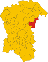 Position of the municipality of Cepagatti within the province of Pescara |
|
| Institutional site | |
Cepagatti It is an Italian municipality of 10 959 inhabitants [2] of the province of Pescara in Abruzzo.
The territory is mainly hilly, and is located on the northern bank of the Pescara Val. The municipal office is 145 meters above sea level. But the heights vary from 100 to 175 meters above sea level .. Cepagatti is crossed by the Pescara river and the Nora stream. It borders the north west with Pianella, to the south with Rosciano, east with Chieti and San Giovanni Teatino and north-east with Spoltore.
The first mention of Cepagatti is in the 1147 catalogus baronum as Zepagattum , Then Cippagattum In 1273. According to a hypothesis, the toponym would derive from the Abruzzese CIPIAFOUTHEDS , a term indicating Roman garlic, composed of the two words derived from Latin cepa (onion) e cat (cat), typical in the dialect of the area to indicate plants whose sugary bulb replaces the onion. [5] Archaeological remains found over the years testify to the frequentation of the area by clothing and Romans, and in particular the origins of the country, which will be thickening in the medieval age, date back to the site of an ancient Roman villa, fortified during the barbarian invasions and transformed into a real castle, which has become known as the Marcantonio Castle, during the Lombard invasions. Also the Lombards are attributed to the construction of the Alex Tower, a sighting building located on a road crossing connected to Aternum port trafficking.

Over the centuries, the country experienced numerous gentlemen and dominations, and in 1458 the Chietina Valignani family obtained possession of it, starting the work of economic exploitation of the territory with deforestations and concession of land to the farmers. [6]

Religious architectures [ change | Modifica Wikitesto ]
Church of Santa Lucia Virgin and martyr [ change | Modifica Wikitesto ]
The church was built between the seventeenth and eighteenth centuries, and has a neoclassical style facade with a large stone pediment of the Maiella. [7]
Church of San Rocco [ change | Modifica Wikitesto ]
Dating back to 1657 and part of the complex of the Marcantonio Castle, the small church was commissioned by Olimpia Valignani, mother of the Marquis of Cepagatti Alessandro, as a thank you to the Saint for the end of the plague of 1656. The brick facade has at its top a ‘ newsstand with bell, and presents a rose window and the coat of arms of the Valignani family. Inside the building shows new Gothic characters. [8]
Military architectures [ change | Modifica Wikitesto ]
Torre Alex [ change | Modifica Wikitesto ]
The tower, which bears the name of Alessandro Valignani, feudal lord of the country since 1632, is the main reference point of the country, and over time it has always represented the place of power; Its walls are about three meters thick, a measure that by roughly corresponding to the ten Roman feet it suggests late ancient origins of the structure, probably linked to the Byzantine garrison of the VI-VII century present in Cepagatti. Built on the remains of an existing Roman villa, in its basement plan there are numerous archaeological remains of the different stratifications of the ancient and late medieval site. [8]
Marcantonio Castle [ change | Modifica Wikitesto ]
Starting from the structure of the Alex tower, a more articulated defensive system, connected to the settlement that had made itself formed inside the contours of the Roman villa, and the castle was built using Roman materials of re -use of re -use in the early medieval age in the meantime . Transformed in the nineteenth century into noble residence, it preserves the cruise vaults and the forms of the defensive structure inside, and in its basements there are archaeological remains of a cistern and other Roman structures and subsequent high -medieval and medieval stratifications. The facade is decorated with maiolics presumably of the eighteenth century. Together with Torre Alex, the Castle complex was subjected to extensive restoration works in 2008. [8]
Demographic evolution [ change | Modifica Wikitesto ]
Inhabitants surveyed [9]

From 1985 to 1996, the local artist Mira Cancelli, on the authorization and financing of the Municipality, has enriched with its students the alleys of the historic center of Cepagatti, creating a characteristic series of colored designs, having as its theme the stories and characters of the city.
Next to the walls of the houses inhabited by the citizens of Cepagatti, the drawings offer a unique scenario, which tells of the Lombard, medieval Cepagatti of the noble Antonia Prophet who married the Marquis Filippo Valignani of Chieti, and life in the ancient and almost contemporary country, with the typical activities of the Abruzzo towns.
Some drawings, after 20 years of stay, have been restored by the artist herself, with its students, from 2006 to today, and still need maintenance in some places, especially in those who tell the CePagattese characters who have taken part in the movement Risorgimento.
On August 16, the Palio di San Rocco is held.
Cepagatti’s economy is essentially based on agriculture, which has always been a source of profit. There are many olive plantations that allow, together with neighboring municipalities, to provide an excellent quality olive oil. Destes of wheat and vineyards characterize the remaining territory. Probably due to the demographic increase, Cepagatti is also expanding on an industrial level.
Twinning [ change | Modifica Wikitesto ]
- ^ a b Lajatico is the richest town in Italy. The income map of the Italian pre-plays , in The sun 24 hours , May 27, 2021.
- ^ a b Monthly demographic balance year 2023 (temporary data) . are demo.istat.it , State.
- ^ Seismic classification ( XLS ), are rischi.protezionecivile.gov.it .
- ^ Table of the degrees/day of the Italian municipalities grouped by region and province ( PDF ), in Law August 26, 1993, n. 412 , attached a , National Agency for New Technologies, Energy and Sustainable Economic Development, 1 March 2011, p. 151. URL consulted on April 25, 2012 (archived by URL Original 1 January 2017) .
- ^ Internet Archive, Dictionary of toponymy: history and meaning of Italian geographical names , Garzanti, 1990. URL consulted on April 29, 2022 .
- ^ Cepagatti, fiefdom of the history of Abruzzo . are Treasures of Abruzzo , 23 November 2014. URL consulted on May 12, 2022 .
- ^ Pescara-L’anne diocese, Santa Lucia Virgin and martyr . are diocesipescara.it .
- ^ a b c Bracket, 2013 .
- ^ Statistics I.Stat – state; URL consulted on 28-12-2012 .
- ^ Historical archive of the elections of the Ministry of the Interior, The result of the administrative elections of 6 November 1993 . are Elezionisto.Inban.gov.it .
- ^ Historical archive of the elections of the Ministry of the Interior, The result of the administrative elections of 27 April 1997 . are Elezionisto.Inban.gov.it .
- ^ Registry of the local and regional administrators of the Ministry of the Interior, Malgari Trematerra card . are Amministeri.inban.it .
- ^ Historical archive of the elections of the Ministry of the Interior, The result of the administrative elections of 29 November 1998 . are Elezionisto.Inban.gov.it .
- ^ Historical archive of the elections of the Ministry of the Interior, Result of the administrative elections of 25 May 2003 . are Elezionisto.Inban.gov.it .
- ^ Official Gazette, series n. 36 of 12 February 2008, President of the Republic Decree 28 January 2007 . are gazzettaufficiale.biz .
- ^ Historical archive of the elections of the Ministry of the Interior, Result of the administrative elections of 13 April 2008 . are Elezionisto.Inban.gov.it .
- ^ Historical archive of the elections of the Ministry of the Interior, Result of the administrative elections of 26 May 2013 . are Elezionisto.Inban.gov.it .
Recent Comments