Guzargues — Wikipedia
Guzargues (in Occitan Gusargues ) is a French commune located in the northeast of the Hérault department in the Occitanie region.
Exhibited for a Mediterranean climate, it is drained by the Salaison, the Cadoule. The municipality has a remarkable natural heritage: a Natura 2000 site (the “Hautes Garrigues du Montpelliérais”), a protected space (the “Costières de Nimes”) and two natural areas of ecological, fauna and floristic interest.
Guzargues is a rural commune which has 498 inhabitants in 2020, after having experienced a strong increase in the population since 1962. It is part of the Montpellier attraction area. Its inhabitants are called the Guzarguois or Guzarguoises.

Guzargues is about 14 kilometers north-east of downtown Montpellier.
The territory is divided between the garrigue and a few cultivable land. The old village is located near the departmental road 26 between Castries south-east, Saint-Mathieu-de-Tréviers in the northwest and Assas in the Southwest. The recent constructions of individual houses were carried out around the village and along a road of about a kilometer north heading towards the location The Lirou .
The area of the town represents 1173 hectares for 489 inhabitants residing in the town in the 2011 census.
Neighboring municipalities [ modifier | Modifier and code ]
Climate [ modifier | Modifier and code ]
The climate that characterizes the municipality was qualified, in 2010, as a “Mediterranean climate franc”, according to the typology of the climates of France which then had eight main types of climates in mainland France [ first ] . In 2020, the municipality came out of the “Mediterranean climate” type in the classification established by Météo-France, which now only has at first approach, only five main types of climates in mainland France. For this type of climate, winters are soft and hot summers, with significant sunshine and frequent strong winds [ 2 ] .
The climatic parameters which made it possible to establish the typology of 2010 have six variables for temperatures and eight for precipitation, whose values correspond to normal 1971-2000 [ Note 1 ] . The seven main variables characterizing the municipality are presented in the following box [ first ] .
|
With climate change, these variables have evolved. A study carried out in 2014 by the Directorate General of Energy and Climate [ 4 ] supplemented by regional studies [ 5 ] provides indeed that the average temperature should grow and the average rainfall is lower, with high regional variations. These changes can be noted on the nearest Météo-France weather station, “Saint-Drezery”, in the town of Saint-Drézéry, commissioned in 1980 [ 6 ] and which is 5 km as the crow flies [ 7 ] , [ Note 3 ] , where the average annual temperature is 14.3 °C and the precipitation height of 768.4 mm For the period 1981-2010 [ 8 ] .
On the nearest historical weather station, “Montpellier-Aéroport”, in the town of Mauguio, commissioned in 1946 and 14 km [ 9 ] , the average annual temperature evolves from 14.7 °C For the period 1971-2000 [ ten ] , To 15.1 °C For 1981-2010 [ 11 ] , then 15.5 °C For 1991-2020 [ twelfth ] .
Natural environments and biodiversity [ modifier | Modifier and code ]
Protected spaces [ modifier | Modifier and code ]
Regulatory protection is the strongest mode of intervention to preserve remarkable natural areas and their associated biodiversity [ 13 ] , [ 14 ] .
A protected space is present in the town:
the “Costières de Nimes”, a land acquired (or assimilated) by a conservatory of natural spaces, of an area of 2 027 ha [ 15 ] .
Natura 2000 network [ modifier | Modifier and code ]

The Natura 2000 network is a European ecological network of natural sites of ecological interest developed from the habitats and birds guidelines, made up of special conservation areas (ZSC) and special protection zones (ZPS) [ Note 4 ] .
A Natura 2000 site was defined in the town under the bird directive: the “Hautes Garrigues du Montpelliérais” [ 17 ] , an area of 45 444 ha , housing three couples of Bonelli eagles, or 30% of the regional workforce [ 18 ] .
Natural areas of ecological, fauna and floristic interest [ modifier | Modifier and code ]
The inventory of natural areas of ecological, fauna and floristic interest (ZNIEFF) aims to make coverage of the most interesting areas on the ecological level, essentially in the perspective of improving knowledge of the national natural heritage and providing In the various decision -makers, a tool for assisting the environment of the environment in regional planning.
A znieff of type 1 [ Note 5 ] is identified in the town [ 19 ] ::
The “Font de Salaison and Fait the Euze” ( 324 ha ) [ 20 ] and a znieff of type 2 [ Note 6 ] , [ 19 ] ::
The “plains and garrigues of the north Montpelliérais” ( 13 097 ha ), covering 25 municipalities including six in the Gard and 19 in Hérault [ 21 ] .
- Map of Type 1 and 2 Znieff in Guzargues.
-
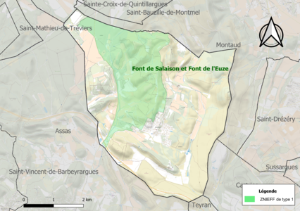
Type 1 Znieff map in the town.
-

Type 2 znieff map in the town.
Typology [ modifier | Modifier and code ]
Guzargues is a rural commune, because it is one of the municipalities that are not very little dense, in the sense of the municipal gate of density of INSEE [ Note 7 ] , [ 22 ] , [ I 1 ] , [ 23 ] .
In addition, the municipality is part of the Montpellier attraction area, of which it is a town in the crown [ Note 8 ] . This area, which brings together 161 municipalities, is categorized in the areas of 700,000 or more inhabitants (excluding Paris) [ I 2 ] , [ I 3 ] .
Land use [ modifier | Modifier and code ]

The occupation of the soils of the town, as it emerges from the European database of Biophysical occupation of the Corine Land Cover (CLC) soils, is marked by the importance of forests and semi-natural environments (57.6 % in 2018), however decreasing compared to 1990 (62.9%). The detailed distribution in 2018 is as follows:
Forests (32.1%), media with shrub and/or herbaceous vegetation (25.5%), heterogeneous agricultural areas (24.5%), permanent crops (13%), urbanized areas (3.5%), zones industrial or commercial and communication networks (1.3%) [ 24 ] .
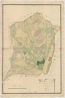
The IGN also provides an online tool to compare the evolution over time of the soil occupation of the municipality (or territories to different scales). Several eras are accessible in the form of aerial cards or photos: the Cassini card ( XVIII It is century), the staff map (1820-1866) and the current period (1950 to today) [ Card 1 ] .
Major risks [ modifier | Modifier and code ]
The territory of the commune of Guzargues is vulnerable to different natural vagaries: meteorological (storm, thunderstorm, snow, very cold, heat wave or drought), floods, forest fires and earthquakes (low seismicity). It is also exposed to a technological risk, the transport of dangerous materials [ 25 ] . A site published by the BRGM makes it possible to simply and quickly assess the risks of a property located either by your address or by the number of its plot [ 26 ] .
Natural risks [ modifier | Modifier and code ]
Certain parts of the municipal territory are likely to be affected by the risk of flooding by overflowing watercourse, in particular the Salaison and the Cadoule. The municipality was recognized as a natural disaster state for damage caused by floods and mudslides that occurred in 1982, 2001, 2002, 2003, 2005 and 2014 [ 27 ] , [ 25 ] .
Guzargues is exposed to the risk of forest fire. A Departmental Fort Forest Protection Plan (PDPFCI) was approved in June 2013 and short until 2022, where it must be renewed. Individual fire prevention measures are specified by two prefectural orders and apply in areas exposed to forest fires and less than 200 meters from these. The decree of Regulates the use of fire by prohibiting in particular from bringing fire, smoking and throwing cigarette butts in sensitive spaces and on the ways which cross them under penalty of sanctions. The decree of Makes the deck compulsory, incumbent on the owner or being entitled [ Note 9 ] , [ 28 ] .

Removing clay soils is likely to cause significant damage to buildings in the event of alternating periods of drought and rain. 88.4% of the municipal area is in medium or strong hazard (59.3% at the departmental level and 48.5% at the national level). Of the 192 buildings counted in the town in 2019, 192 are in a medium or strong hazard, or 100%, to be compared to the 85% at the departmental level and 54% at the national level. A mapping of the national territory exhibition to the swelling of the clay soils is available on the BRGM website [ 29 ] , [ Card 2 ] .
In addition, in order to better understand the risk of subsidence of land, the national inventory of underground cavities makes it possible to locate those located in the town [ 30 ] .
Technological risks [ modifier | Modifier and code ]
The risk of transporting dangerous materials in the town is linked to its crossing by significant road or rail infrastructures or the presence of a hydrocarbon transport pipe. An accident occurring on such infrastructure is likely to have serious effects on goods, people or the environment, depending on the nature of the material transported. Town planning provisions can be recommended accordingly [ thirty first ] .
The municipality was known under the variants: Villa agucianicis (around 922), St. Michael of Aguzanicis (1111), Villa’s Aguzanicis (1156), of Aquitanicis (1208), of Aguzanicis (1550), Gussargues (1626).
The name Guzargues derives from that of a Gallo-Roman domain, Latin kindness Acutius Increased in the suffix -Anicis . The A apheresis is frequent in the names of the region [ 32 ] .
The [ 33 ] , a Forest Fire ravage Guzargues and the surrounding municipalities. About 3000 hectares of garrigue and pine forest were burned.
 |
Coat of arms |
Azure to Saint Michel d’Or terrifying a devil of the same
|
|---|---|---|
| Details |
Saint Michael is the patron saint of Guzargues, he is represented here as Christian iconography represents him terrifying a dragon. |
Mayors [ modifier | Modifier and code ]
Intercommunality [ modifier | Modifier and code ]
The municipality of Guzargues adheres to several public inter-municipal cooperation establishments: the community of communes of the Grand Pic Saint-Loup, the mixed union of Garrigues campaign for the management of drinking water and raw water, and the management union of the Assas-Guzargues school group.
The evolution of the number of inhabitants is known through the population censuses made in the municipality since 1793. From 2006, the legal populations of the municipalities are published annually by INSEE. The census is now based on an annual information collection, successively concerning all the municipal territories during a period of five years. For municipalities with less than 10,000 inhabitants, a census survey relating to the entire population is carried out every five years, the legal populations of the intermediate years being estimated by interpolation or extrapolation [ 34 ] . For the municipality, the first exhaustive census falling within the framework of the new system was carried out in 2008 [ 35 ] .
In 2020, the town had 498 inhabitants [ Note 10 ] , decreased by 3.49%compared to 2014 (Hérault: +7.37%, France excluding Mayotte: +13%).
Income [ modifier | Modifier and code ]
In 2018, the municipality has 182 tax households [ Note 11 ] , bringing together 478 people. The median of disposable income per unit of consumption is 29,230 € € [ I 4 ] (20 330 € € in the departement [ I 5 ] ).
Job [ modifier | Modifier and code ]
| 2008 | two thousand and thirteen | 2018 | |
|---|---|---|---|
| Commune [ I 6 ] | 5% | 7.2% | 6.6% |
| Department [ I 7 ] | 10.1% | 11.9% | twelfth % |
| Whole France [ I 8 ] | 8.3% | ten % | ten % |
In 2018, the population aged 15 to 64 amounted to 332 people, including 72.3% of assets (65.7% having a job and 6.6% of unemployed) and 27.7% inactive [ Note 12 ] , [ I 6 ] . Since 2008, the municipal unemployment rate (within the meaning of the census) of 15-64 years is lower than that of France and the department.
The town is part of the crown of the Montpellier attraction area, because at least 15% of the active workers work in the pole [ Card 3 ] , [ I 9 ] . It has 42 jobs In 2018, against 41 in 2013 and 27 in 2008. The number of assets having a job residing in the municipality is 223, an indicator of employment concentration of 18.6% and an activity rate among 15 or more than 56.2% [ I 10 ] .
Of these 223 assets aged 15 or over having a job, 22 work in the town, or 10% of the inhabitants [ I 11 ] . To get to work, 84.8% of the inhabitants use a personal or four-wheeled function vehicle, 3.1% public transport, 5.3% go there in two-wheelers, by bike or on foot And 6.7% do not need transport (home work) [ I 12 ] .
Activities outside agriculture [ modifier | Modifier and code ]
Sectors [ modifier | Modifier and code ]
44 establishments [ Note 13 ] are located in Guzargues at . The table below details the number by sector of activity and compares the ratios with those of the department [ Note 14 ] , [ I 13 ] .
| Activity area | Commune | Department | |
|---|---|---|---|
| Name | % | % | |
| Ensemble | 44 | ||
| Manufacturing industry, extractive industries and others |
3 | 6.8% | (6.7%) |
| Construction | 8 | 18.2% | (14.1%) |
| Wholesale and retail, Transport, accommodation and catering |
7 | 15.9% | (28%) |
| Information et communication | 2 | 4.5% | (3.3%) |
| Real estate activities | 2 | 4.5% | (5.3%) |
| Specialized, scientific and technical activities and administrative and support activities |
15 | 34.1% | (17.1%) |
| Public administration, education, Human health and social action |
5 | 11.4% | (14.2%) |
| Other service activities | 2 | 4.5% | (8.1%) |
The sector of specialized, scientific and technical activities and administrative and support activities is preponderant in the municipality since it represents 34.1% of the total number of establishments in the municipality (15 out of the 44 companies located in Guzargues) , against 17.1% at the departmental level [ I 14 ] .
Companies and businesses [ modifier | Modifier and code ]
The three companies with their registered office in the municipal territory which generate the most turnover in 2020 are [ 38 ] :
- MTP sanitation, wastewater collection and treatment (727 k€ )
- Embrun Vappereau Development – EVD, activities of Holding companies (411 k€ )
- Plumbing comfort Energies, the installation of thermal equipment and air conditioning (164 k€ )
Agriculture [ modifier | Modifier and code ]
The municipality is in the “Soubergues”, a small agricultural region occupying the northeast of the Hérault department [ 39 ] . In 2020, the technical and economic orientation of agriculture [ Note 15 ] In the town is viticulture [ Map 4 ] .
| 1988 | 2000 | 2010 | 2020 | |
|---|---|---|---|---|
| Farms | 8 | 7 | ten | twelfth |
| AFTER [ Note 16 ] (ha) | 152 | 154 | 144 | 318 |
The number of active farms in activity and having their headquarters in the town went from 8 during the agricultural census of 1988 [ Note 17 ] at 7 in 2000 then at 10 in 2010 [ 41 ] and finally at 12 in 2020 [ Map 5 ] , an increase of 50% in 32 years. A downward movement is on the other hand observed on the scale of the department which lost during this period 67% of its operations [ 42 ] , [ Map 6 ] . The agricultural area used in the town has increased, going from 152 ha In 1988 to 318 ha In 2020 [ Map 7 ] . At the same time, the agricultural area used average per farm has increased, from 19 to 27 ha [ 41 ] .
Places and monuments [ modifier | Modifier and code ]
Personalities linked to the municipality [ modifier | Modifier and code ]
- Jean Joubert (born in 1928, died in 2015), French poet and novelist.
- Corinne Blanc-Fauge, actress [ 44 ]
Notes and cards [ modifier | Modifier and code ]
- The normals are used to represent the climate. They are calculated over 30 years and updated every decades. After the normal 1971-2000, the normal for the period 1981-2010 have been defined and, since 2021, it was the normal 1991-2020 which refer in Europe and in the world [ 3 ] .
- The annual thermal amplitude measures the difference between the average temperature of July and that of January. This variable is generally recognized as a criterion of discrimination between ocean and continental climates.
- The distance is calculated as the crow flies between the weather station proper and the capital of commune.
- In Natura 2000 sites, Member States undertake to maintain in a favorable state of conservation the types of habitats and species concerned, through regulatory, administrative or contractual measures [ 16 ] .
- The Znieff of type 1 are sectors of an area generally limited, characterized by the presence of species, association of rare species or environments, remarkable, or characteristics of the regional or national natural heritage environment.
- The Znieff of type 2 are large rich, or little modified natural sets, which offer significant biological potential.
- According to the zoning of rural and urban municipalities published in November 2020, in application of the new definition of validated rurality in the interministerial rurality committee.
- The concept of cities attraction areas replaced the old concept of urban area in October 2020 to allow comparisons consistent with other countries of the European Union.
- The clearing applies in particular around constructions, sites, works or installations over a width of 50 meters (according to a principle of insurance law, any owner is required to ensure the protection of his property), and 5 meters of part and others private routes giving access to it.
- Legal municipal population in force at 1 is January 2023, vintage 2020, defined within the territorial limits in force at 1 is January 2022, Statistical reference date: 1 is January 2020.
- A tax household is made up of the grouping of tax households listed in the same accommodation. Its existence, a given year, is due to the fact that at least an independent income declaration coincide and the occupation of a housing known to the housing tax.
- Inactive inactive, in the sense of INSEE, students, students, students, unpaid trainees, pre-retired, retirees and other inactive.
- The establishment, in the sense of INSEE, is a geographically individualized production unit, but legally dependent on the legal unit. It produces goods or services.
- The field of this painting covers market activities outside agriculture.
- Technical-economic orientation is the dominant production of exploitation, determined according to the contribution of each surface or livestock to standard gross production.
- The data relating to the agricultural area used (SAU) are located in the municipality where the main place of production of each farm is located. The figures of a municipality must therefore be interpreted with caution, an exploitation which can exercise its activity in several municipalities, or several departments or even several regions.
- The agricultural census is a European and compulsory ten -year operation which aims to update data on French agriculture and to measure its weight in European agriculture [ 40 ] .
- IGN, ‘ Evolution of the town’s land use on ancient maps and photos. » , on Remonterletemps.ign.fr (consulted the ) . To compare the evolution between two dates, click on the bottom of the vertical dividing line and move it to the right or left. To compare two other cards, choose the cards in the windows at the top left of the screen.
- ‘ Interactive mapping of the soils exposure to remonstration of clays » , on infoterre.brgm.fr (consulted the )
- National Agency for Territorial Cohesion, ‘ Map of the municipality in the zoning of areas of attraction of cities. » , on The Observatory of Territories (consulted the ) .
- ‘ Agricultural census 2020 – Map of the specialization of agricultural production by municipality » , on stats.agriculture.gouv.fr (consulted the ) .
- ‘ Agricultural census 2020 – Map of the number of farms and the agricultural area used (SAU) average per municipality » , on stats.agriculture.gouv.fr (consulted the ) .
- ‘ Agricultural census 2020 – Map of the number of farms and the agricultural area used by department » , on stats.agriculture.gouv.fr (consulted the ) .
- ‘ Agricultural census 2020 – Map of the agricultural area used (SAU) by municipality and SAU MADE » , on stats.agriculture.gouv.fr (consulted the ) .
References [ modifier | Modifier and code ]
INSEE website [ modifier | Modifier and code ]
Other sources [ modifier | Modifier and code ]
- Daniel Joly, Thierry Brossard, Hervé Cardot, Jean Cavailhes, Mohamed Hilal and Pierre Wavresky, ” Types of climates in France, a spatial construction », Cybergéo, European Geography Review – European Journal of Geography , n O 501, (DOI https://doi.org/10.4000/Cybergeo.23155 , read online , consulted the )
- ‘ The climate in mainland France » , on http://www.meteofrance.fr , (consulted the )
- 2021: new normal to qualify the climate in France , Météo-France, January 14, 2021.
- ‘ The climate of France in the 21st century – Volume 4 – Regionalized scenarios: 2014 edition for the metropolis and overseas regions » , on https://www.ecologie.gouv.fr (consulted the ) .
- ‘ Regional Observatory on Agriculture and Climate Change (Oracle) Occitania » , on Occitanie.chambre-agriculture.fr , (consulted the )
- ‘ Météo-France Saint-Drezery-Metadata station » , on DONNEESPULIQUES.METEOFRance.fr (consulted the )
- ‘ Orthodrome between Guzargues and Saint-Drezéry » , on Fr.distance.to (consulted the ) .
- ‘ Météo-France Saint-Drezery station-Climatological sheet-Statistics 1981-2010 and records » , on DONNEESPULIQUES.METEOFRance.fr (consulted the ) .
- ‘ Orthodrome between Guzargues and Mauguio » , on Fr.distance.to (consulted the ) .
- ‘ Meteorological station of Montpellier-Aerport-Normal for the period 1971-2000 » , on https://www.infoclimat.fr (consulted the )
- ‘ Meteorological station of Montpellier-Aerport-Normal for the period 1981-2010 » , on https://www.infoclimat.fr (consulted the )
- ‘ Meteorological station of Montpellier-Aerport-Normal for the period 1991-2020 » , on https://www.infoclimat.fr (consulted the )
- ‘ Protected spaces. » , on the INPN website (consulted the )
- ‘ List of protected areas in the town » , on the National Inventory of Natural Heritage Inventory (consulted the )
- ‘ – fact sheet » , on the National Inventory of Natural Heritage Inventory (consulted the ) .
- European Natura 2000 network , Ministry of Ecological and Solidarity Transition
- ‘ List of Natura 2000 zones in the town of Guzargues » , on the National Inventory of Natural Heritage Inventory (consulted the ) .
- ‘ site Natura 2000 FR9112004 – fiche descriptive » , on the National Inventory of Natural Heritage Inventory (consulted the )
- ‘ List of Znieffs in the town of Guzargues » , on the National Inventory of Natural Heritage Inventory (consulted the ) .
- ‘ Znieff the “Font de Salaison and Fait de l’Euze” – Descriptive sheet » , on the National Inventory of Natural Heritage Inventory (consulted the ) .
- ‘ Znieff The “Plains and Garrigues of the North Montpelliérais” – Descriptive sheet » , on the National Inventory of Natural Heritage Inventory (consulted the ) .
- ‘ Urban / rural typology » , on www.observatoire-des -territoires.gouv.fr (consulted the ) .
- ‘ Understand the density grid » , on www.observatoire-des -territoires.gouv.fr (consulted the ) .
- ‘ Corine Land Cover (CLC) – Distribution of areas in 15 land use stations (metropolitan area). » , on the Statistical data and studies site of the Ministry of Ecological Transition. (consulted the )
- ‘ Risks near my home – Municipality of Guzargues » , on Georisque (consulted the )
- BRGM, ‘ Simply and quickly assess the risks of your property » , on Georisque (consulted the )
- ‘ Major risks in Hérault » , on www.herault.gouv.fr (consulted the ) , Part 1 – Chapter Risk Flood.
- ‘ Major risks in Hérault » , on www.herault.gouv.fr (consulted the ) , chapter forest fires.
- ‘ Removal-clay with clays » , on the Site of the National Observatory of Natural Risks (consulted the )
- ‘ List of underground cavities located in the town of Guzargues » , on http://www.geisques.gouv.fr (consulted the )
- ‘ Major risks in Hérault » , on www.herault.gouv.fr (consulted the ) , chapter risk transport of dangerous materials.
- Frank R. Hamlin and Abbé André Cabrol, Place names in the Hérault department: topographic and etymological dictionary , , 415 p. (ISBN 2-904624-00-7 , read online ) , p. 188
- [PDF] Prefect of Hérault, decree of October 7, 2010 ; File hosted on the site of the Departmental Federation of Hérault Hunters, accessed April 4, 2015.
- The organization of the census , on INSEE.fr.
- Departmental censuses calendar , on INSEE.fr.
- From the villages of Cassini to today’s municipalities On the site of the School of Advanced Studies in Social Sciences.
- INSEE – Legal populations of the town for years 2006 , 2007 , 2008 , 2009 , 2010 , 2011 , 2012 , two thousand and thirteen , 2014 , 2015 , 2016 , 2017 , 2018 , 2019 And 2020 .
- ‘ Companies in Guzargues » , on Entrepses.lefigaro.fr (consulted the ) .
- ‘ Agricultural regions (RA), small agricultural regions (PRA) – Reference year: 2017 » , on Agreste.agriculture.gouv.fr (consulted the ) .
- Presentation of the first results of the 2020 agricultural census , Ministry of Agriculture and Food, December 10, 2021
- ‘ Agricultural census sheet – farms with their headquarters in the commune of Guzargues – general data » , on Recensement-agricole.agriculture.gouv.fr (consulted the ) .
- ‘ Agricultural census sheet – farms with their headquarters in the Hérault department » (consulted the ) .
- ‘ Saint-Michel Church » , on www.pop.culture.gouv.fr (consulted the )
- https://www.midilibre.fr, 2011/10/26/corinne-canc-comedienne-a-dit-ouo-a-david-faugere,407990.php
Archive fund [ modifier | Modifier and code ]
Related articles [ modifier | Modifier and code ]
external links [ modifier | Modifier and code ]
- Geography resources :
- Resource relating to several areas :
- Resource relating to organizations :
Recent Comments