Shaw Heights, Colorado – Wikipedia
From Wikipedia, the free encyclopedia
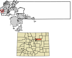
Census Designated Place in Colorado, United States
|
Shaw Heights, Colorado |
|
|---|---|
 |
|

|
|
| Coordinates:
39°51′24″N 105°02′21″W / 39.8566176°N 105.0390737°WCoordinates: 39°51′24″N 105°02′21″W / 39.8566176°N 105.0390737°W[1] |
|
| Country | |
| State | |
| County | Adams County |
| Government | |
| • Type | unincorporated community |
| Area | |
| • Total | 0.701 sq mi (1.816 km2) |
| • Land | 0.700 sq mi (1.814 km2) |
| • Water | 0.0008 sq mi (0.002 km2) |
| Elevation | 5,512 ft (1,680 m) |
| Population | |
| • Total | 5,116 |
| • Density | 7,309/sq mi (2,820/km2) |
| Time zone | UTC-7 (MST) |
| • Summer (DST) | UTC-6 (MDT) |
| ZIP Code[3] | |
| Area codes | 303 & 720 |
| GNIS feature[2] | Shaw Heights CDP |
Shaw Heights is an unincorporated community and a census-designated place (CDP) located in and governed by Adams County, Colorado, United States. The CDP is part of the Denver–Aurora–Lakewood, CO Metropolitan Statistical Area. The population of the Shaw Heights CDP was 5,116 at the United States Census 2010.[4] The Westminster post office (Zip code 80031) serves the area.[3]
Geography[edit]
The Shaw Heights CDP has an area of 449 acres (1.816 km2), including 0.49 acres (0.002 km2) of water.[1]
Demographics[edit]
The United States Census Bureau initially defined the Shaw Heights CDP for the United States Census 2010.
Education[edit]
Shaw Heights is served by Westminster Public Schools.
- Shaw Heights Middle School
See also[edit]
References[edit]
- ^ a b c
“State of Colorado Census Designated Places – BAS20 – Data as of January 1, 2020”. United States Census Bureau. Retrieved December 14, 2020.
- ^ a b c “U.S. Board on Geographic Names: Domestic Names”. United States Geological Survey. Retrieved December 14, 2020.
- ^ a b “Zip Code 80031 Map and Profile”. zipdatamaps.com. 2020. Retrieved December 20, 2020.
- ^ “2010: DEC Summary File 1”. United States Census Bureau. Retrieved December 20, 2020.
External links[edit]
Recent Comments