Rajpipla railway station – Wikipedia
before-content-x4
From Wikipedia, the free encyclopedia
| Indian Railways station | |
Indian Railway Stations logo |
|
| General information | |
| Location | Gujarat State Highway 160, Rajpipla, Narmada district, Gujarat India |
| Coordinates |
21°52′41″N 73°30′14″E / 21.8781°N 73.5040°ECoordinates: 21°52′41″N 73°30′14″E / 21.8781°N 73.5040°E |
| Elevation | 41 metres (135 ft) |
| Owned by | Indian Railways |
| Operated by | Western Railway |
| Line(s) | Ankleshwar–Rajpipla section |
| Platforms | 1 |
| Tracks | 2 |
| Construction | |
| Structure type | Standard (on-ground station) |
| Parking | No |
| Bicycle facilities | No |
| Other information | |
| Status | Single diesel line |
| Station code | RAJ |
| Zone(s) | Western Railway |
| Division(s) | Vadodara |
| Electrified | Ongoing |
| Location | |

Location within India 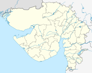
Rajpipla railway station (Gujarat) |
|
Rajpipla railway station is a small railway station in Narmada district, Gujarat. Its code is RAJ. It serves Rajpipla town. The station consists of a single platform. The platform is not well sheltered. It lacks many facilities including water and sanitation.[1][2][failed verification][3][failed verification][4][failed verification][5][failed verification]
References[edit]
See also[edit]
after-content-x4
Recent Comments