| Registered Texas Historic Landmark
|
Image
|
Marker number
|
Physical address
|
Nearest city
|
Year designated
|
Description
|
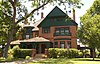
| Albert Turner Clifton House
|
|
103
|
2600 Austin Ave.
31°32′22″N 97°9′4″W / 31.53944°N 97.15111°W / 31.53944; -97.15111
|
Waco
|
1991
|
2600 Austin (26th Austin)
|
Alico Building |

 More images More images
|
118
|
425 Austin Ave.
31°33′25″N 97°7′55″W / 31.55694°N 97.13194°W / 31.55694; -97.13194
|
Waco
|
1982
|
425 Austin Ave. (4th Austin), Waco
|
| Austin Avenue Methodist Church |

More images
|
241
|
1300 Austin Ave.
31°33′0″N 97°8′20″W / 31.55000°N 97.13889°W / 31.55000; -97.13889
|
Waco
|
1990
|
1300 Austin Ave. (13th Austin), Waco
|
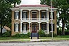
| Bagby House
|
|
274
|
1825 S. Eighth St.
31°32′27″N 97°7′7″W / 31.54083°N 97.11861°W / 31.54083; -97.11861
|
Waco
|
1983
|
1825 S. 8th (corner of S. 8th St. and Wood Ave) – razed in 2014
|
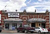
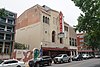
| Best Theatre Building
|
More images
|
386
|
218 N. Main St.
31°48′11″N 97°5′30″W / 31.80306°N 97.09167°W / 31.80306; -97.09167
|
West
|
1994
|
218 N Main
|
| Bull Hide Creek Iron Bridge
|
|
14774
|
W of I-35 over Bull Hide Creek between Lorena and Hewitt
31°25′2″N 97°11′59″W / 31.41722°N 97.19972°W / 31.41722; -97.19972
|
Waco
|
1994
|
|
| Deyerle-Fall House
|
|
12118
|
917 Old Oglesby Rd.
31°26′8″N 97°26′19″W / 31.43556°N 97.43861°W / 31.43556; -97.43861
|
McGregor
|
1998
|
|
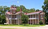
| Earle-Harrison House
|
|
1334
|
1901 N. Fifth St.
31°34′9″N 97°8′53″W / 31.56917°N 97.14806°W / 31.56917; -97.14806
|
Waco
|
1970
|
1901 N. 5th St., Waco
|
Earle-Napier-Kinnard House |

|
1335
|
814 S. Fourth St.
31°34′43″N 97°7′21″W / 31.57861°N 97.12250°W / 31.57861; -97.12250
|
Waco
|
1969
|
814 S. 4th (at corner of 4th & I-35), Waco
|
| East Terrace |
|
1368
|
100 Mill St.
31°34′2″N 97°8′1″W / 31.56722°N 97.13361°W / 31.56722; -97.13361
|
Waco
|
1962
|
100 Mill Ave. (corner of Mill and Lake Brazos Dr; House faces Lake Brazos Dr.), Waco
|
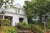
| Eddy Methodist Church
|
|
1386
|
404 W. Third St.
31°17′49″N 97°15′22″W / 31.29694°N 97.25611°W / 31.29694; -97.25611
|
Eddy
|
1993
|
Corner of SH 107 and Ausborn St., Eddy
|
| Elite Cafe
|
|
1454
|
2132 S. Valley Mills Dr.
31°31′29″N 97°7′58″W / 31.52472°N 97.13278°W / 31.52472; -97.13278
|
Waco
|
1994
|
2132 S. Valley Mills Dr. (on the Circle Off I-35), Waco
|
| First Lutheran Church
|
|
1736
|
1008 Jefferson Ave.
31°33′19″N 97°8′23″W / 31.55528°N 97.13972°W / 31.55528; -97.13972
|
Waco
|
1984
|
1008 Jefferson (10th & Jefferson), Waco
|
| Flowers House
|
|
12121
|
600 W. Third St.
31°17′51″N 97°15′27″W / 31.29750°N 97.25750°W / 31.29750; -97.25750
|
Eddy
|
1998
|
600 W. Third Street
|
| Forsgard House |
More images
|
12905
|
1122 N. Fourth St.
31°33′51″N 97°8′24″W / 31.56417°N 97.14000°W / 31.56417; -97.14000
|
Waco
|
2002
|
1122 North Fourth
|
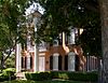
| Fort House |
More images
|
1990
|
503 S. Fourth St.
31°33′14″N 97°7′35″W / 31.55389°N 97.12639°W / 31.55389; -97.12639
|
Waco
|
1969
|
503 South 4th St.
|
| George W. Carroll Science Hall
|
|
16017
|
1401 S. Fifth St.
31°32′47″N 97°7′13″W / 31.54639°N 97.12028°W / 31.54639; -97.12028
|
Waco
|
2009
|
|
| Glenn and Mary Gulledge Crain House
|
|
12897
|
705 S. Adams St.
31°26′3″N 97°24′26″W / 31.43417°N 97.40722°W / 31.43417; -97.40722
|
McGregor
|
2002
|
705 S. Adams St
|
| Groppe Barn
|
|
2288
|
SE on private road from FM 3149 at Groppe Rd.
31°44′26″N 97°3′55″W / 31.74056°N 97.06528°W / 31.74056; -97.06528
|
West
|
1991
|
From West, take Main St. south from center of town one mile, take Cemetery Rd. east, go 2.5 more miles to Barn
|
| Groppe Building
|

More images
|
2289
|
130 N. Main St.
31°48′8″N 97°5′31″W / 31.80222°N 97.09194°W / 31.80222; -97.09194
|
West
|
1983
|
130 N. Main (Corners of Main & Oak), West.
|
| H. J. and Cora Hudson House
|
|
18674
|
306 S. Bordon St.
31°23′1″N 97°12′56″W / 31.38361°N 97.21556°W / 31.38361; -97.21556
|
Lorena
|
2017
|
Behind sidewalk in front (to the east) of the H. J. and Cora Hudson House on 306 South Bordon Street in Lorena, Texas
|
| H. & T. C. Railroad
|
|
2311
|
Off S. Martin Luther King, Jr. Blvd. between Taylor St. and E. Bridge St.
31°33′45″N 97°7′30″W / 31.56250°N 97.12500°W / 31.56250; -97.12500
|
Waco
|
1966
|
N/A
|
| Hill House
|
|
2483
|
901 Ave. E
31°18′20″N 97°21′46″W / 31.30556°N 97.36278°W / 31.30556; -97.36278
|
Moody
|
1989
|
901 Ave. E, Moody
|
| Hoyle Cabin
|
|
2507
|
421 Rice Ave.
31°34′43″N 97°9′10″W / 31.57861°N 97.15278°W / 31.57861; -97.15278
|
Waco
|
1963
|
421 Rice Ave on western edge of Cameron Park in Waco (on private property)
|
| Johnson-Taylor House
|
|
2838
|
1705 N. Fifth St.
31°34′5″N 97°8′47″W / 31.56806°N 97.14639°W / 31.56806; -97.14639
|
Waco
|
1963
|
1705 N. 5th St., Waco (corner of 5th & Garland); (also called Nell Pape Garden Center)
|
| Kuykendall House
|
|
2978
|
300 Estelle Rice St.
31°18′26″N 97°21′51″W / 31.30722°N 97.36417°W / 31.30722; -97.36417
|
Moody
|
1979
|
corner of Estelle Rice & Ave. F.,Moody
|
| Lorena United Methodist Church
|

More images
|
5372
|
205 S. Bordon St.
31°23′4″N 97°12′54″W / 31.38444°N 97.21500°W / 31.38444; -97.21500
|
Lorena
|
1976
|
Corner of Borden & Bettie Sts., Lorena
|
| Lusk House
|
|
3148
|
301 Jefferson Ave.
31°33′42″N 97°8′2″W / 31.56167°N 97.13389°W / 31.56167; -97.13389
|
Waco
|
1965
|
301 Jefferson (3rd & Jefferson), Waco
|
| McLennan County Courthouse#
|

More images
|
3302
|
501 Washington Ave.
31°33′26″N 97°8′1″W / 31.55722°N 97.13361°W / 31.55722; -97.13361
|
Waco
|
1970
|
Between 5th and 6th on Washington, Waco (Courthouse Square)
|
| Old Main
|

|
16018
|
1411 S. Fifth St.
31°32′45″N 97°7′13″W / 31.54583°N 97.12028°W / 31.54583; -97.12028
|
Waco
|
2009
|
|
| Old Walker Homestead
|
|
3829
|
3401 Dever Dr.
31°34′2″N 97°11′11″W / 31.56722°N 97.18639°W / 31.56722; -97.18639
|
Waco
|
1969
|
|
| Rotan-Dosset House |
More images
|
4358
|
1503 Columbus Ave.
31°33′1″N 97°8′35″W / 31.55028°N 97.14306°W / 31.55028; -97.14306
|
Waco
|
1978
|
1503 Columbus (15th & Columbus), Waco
|
| Saint Paul’s Episcopal Church
|
|
4482
|
501 Columbus Ave.
31°33′31″N 97°8′5″W / 31.55861°N 97.13472°W / 31.55861; -97.13472
|
Waco
|
1963
|
501 Columbus (5th Columbus), Waco
|
| St. James United Methodist Church
|
|
4444
|
600 S. Second St.
31°33′19″N 97°7′26″W / 31.55528°N 97.12389°W / 31.55528; -97.12389
|
Waco
|
1986
|
600 S. 2nd (2nd & clay St.), Waco
|
| Stratton-Stricker Building |
|
18271
|
800 Austin Ave.
31°33′15″N 97°8′4″W / 31.55417°N 97.13444°W / 31.55417; -97.13444
|
Waco
|
2015
|
Southwest corner of 8th and Austin, on sidewalk facing Austin Avenue
|
| The C. C. McCulloch House |

More images
|
5397
|
406 Columbus Ave.
31°33′32″N 97°7′58″W / 31.55889°N 97.13278°W / 31.55889; -97.13278
|
Waco
|
1979
|
(4th & Columbus), Waco
|
| The Cottonland Castle |
|
5314
|
3300 Austin Ave.
31°32′1″N 97°9′28″W / 31.53361°N 97.15778°W / 31.53361; -97.15778
|
Waco
|
1977
|
3300 Austin Avenue
|
| The George Butler – Jesse Harrison House
|
|
2154
|
1018 Taylor Ave.
31°34′12″N 97°7′9″W / 31.57000°N 97.11917°W / 31.57000; -97.11917
|
Waco
|
1971
|
|
| The Howard House
|
|
5356
|
800 Ave. E
31°18′23″N 97°21′47″W / 31.30639°N 97.36306°W / 31.30639; -97.36306
|
Moody
|
1978
|
800 Ave. E, Moody
|
| The Isaac Jackson Teague Property
|
|
5358
|
172 Teague Dr.
31°17′50″N 97°21′47″W / 31.29722°N 97.36306°W / 31.29722; -97.36306
|
Moody
|
1976
|
From Moody take 1/2 mile south on Highway 317, east of 317 and south of cemetery.
|
| The Sims Cabin
|
|
5427
|
1020 Sleepy Hollow Rd.
31°30′16″N 97°14′1″W / 31.50444°N 97.23361°W / 31.50444; -97.23361
|
Waco
|
1963
|
on private property in the Woodway Neighborhood, .
|
| The Sturgis House |
|
5433
|
1316 Washington Ave.
31°33′2″N 97°8′26″W / 31.55056°N 97.14056°W / 31.55056; -97.14056
|
Waco
|
1971
|
across from St. Mary’s
|
| W. H. Janes Home
|
|
5672
|
N of FM 308 W of Fajkus Rd.
31°45′16″N 97°0′44″W / 31.75444°N 97.01222°W / 31.75444; -97.01222
|
Leroy
|
1981
|
From Leroy 2 mi E on FM 2311, off-road on southside (private property)
|
| Waco Theatre |
More images
|
5694
|
724 Austin Ave.
31°33′16″N 97°8′3″W / 31.55444°N 97.13417°W / 31.55444; -97.13417
|
Waco
|
1981
|
|
| Watson Feed Store
|

|
15253
|
308 E. Texas Ave.
31°32′29″N 96°50′5″W / 31.54139°N 96.83472°W / 31.54139; -96.83472
|
Mart
|
2003
|
|
| Wesley United Methodist Church
|
|
18221
|
125 Turner St.
31°34′6″N 97°7′22″W / 31.56833°N 97.12278°W / 31.56833; -97.12278
|
Waco
|
2015
|
Northeast corner of Turner St and Elm, directly behind the old Bailsbondsman building on Elm St.
|
Recent Comments