Laird, Colorado – Wikipedia
From Wikipedia, the free encyclopedia
Unincorporated community in Colorado, United States
Census Designated Place in Colorado, United States
|
Laird, Colorado |
|
|---|---|
 |
|

|
|
| Coordinates:
40°04′54″N 102°06′07″W / 40.0818012°N 102.1018979°WCoordinates: 40°04′54″N 102°06′07″W / 40.0818012°N 102.1018979°W[1] |
|
| Country | |
| State | |
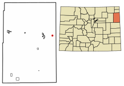
| County | Yuma County |
| Government | |
| • Type | unincorporated town |
| Area | |
| • Total | 0.150 sq mi (0.389 km2) |
| • Land | 0.150 sq mi (0.389 km2) |
| • Water | 0.000 sq mi (0.000 km2) |
| Elevation | 3,402 ft (1,037 m) |
| Population | |
| • Total | 47 |
| • Density | 313/sq mi (121/km2) |
| Time zone | UTC-7 (MST) |
| • Summer (DST) | UTC-6 (MDT) |
| ZIP Code[3] |
80758 |
| Area code | 970 |
| GNIS feature[2] | Laird CDP |
Laird is an unincorporated community and a census-designated place (CDP) located in and governed by Yuma County, Colorado, United States. The population of the Laird CDP was 47 at the United States Census 2010.[4] The Wray post office (Zip Code 80758) serves Laird postal addresses.[3] Laird has the lowest elevation of any community in Colorado at 3,402 feet (1,037 m).
Etymology[edit]
Laird has the name of James Laird, a Nebraska legislator.[5]“Laird” is the Scots language word for a “lord”.
History[edit]
The Laird post office began operation in 1887.[6]
Geography[edit]
The Laird CDP has an area of 96 acres (0.389 km2), all land.[1]
Demographics[edit]
The United States Census Bureau initially defined the Laird CDP for the United States Census 2010.
See also[edit]
References[edit]
- ^ a b c
“State of Colorado Census Designated Places – BAS20 – Data as of January 1, 2020”. United States Census Bureau. Retrieved December 28, 2020.
- ^ a b c “U.S. Board on Geographic Names: Domestic Names”. United States Geological Survey. Retrieved December 28, 2020.
- ^ a b “Zip Code 80758 Map and Profile”. zipdatamaps.com. 2020. Retrieved December 28, 2020.
- ^ “2010: DEC Summary File 1”. United States Census Bureau. Retrieved December 28, 2020.
- ^ Dawson, John Frank. Place names in Colorado: why 700 communities were so named, 150 of Spanish or Indian origin. Denver, CO: The J. Frank Dawson Publishing Co. p. 30.
- ^ “Post offices”. Jim Forte Postal History. Retrieved 29 June 2016.
External links[edit]
| Cities |
 |
|
|---|---|---|
| Town | ||
| CDPs | ||
| Unincorporated community |
||
| Ghost towns | ||
Recent Comments