Foucart – Wikipedia
From Wikipedia, the free encyclopedia
Commune in Normandy, France
|
Foucart |
|
|---|---|
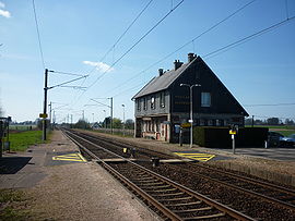 The railway station in Foucart |
|
|
Location of Foucart  |
|
 Show map of France  Show map of Normandy |
|
| Coordinates:
49°36′52″N 0°35′46″E / 49.6144°N 0.5961°E / 49.6144; 0.5961Coordinates: 49°36′52″N 0°35′46″E / 49.6144°N 0.5961°E / 49.6144; 0.5961 |
|
| Country | France |
| Region | Normandy |
| Department | Seine-Maritime |
| Arrondissement | Le Havre |
| Canton | Saint-Valery-en-Caux |
| Intercommunality | Caux Seine Agglo |
| Government | |
| • Mayor
(2020–2026) |
Antoine Servain[1] |
| Area
1 |
4.28 km2 (1.65 sq mi) |
| Population | 359 |
| • Density | 84/km2 (220/sq mi) |
| Time zone | UTC+01:00 (CET) |
| • Summer (DST) | UTC+02:00 (CEST) |
| INSEE/Postal code | |
| Elevation | 128–149 m (420–489 ft) (avg. 140 m or 460 ft) |
| 1 French Land Register data, which excludes lakes, ponds, glaciers > 1 km2 (0.386 sq mi or 247 acres) and river estuaries. | |


Foucart (French pronunciation: [fukaʁ]) is a commune in the Seine-Maritime department in the Normandy region in northern France.
Geography[edit]
A farming village situated in the Pays de Caux, some 21 miles (34 km) northeast of Le Havre, at the junction of the D40, D104 and D29 roads. The A29 autoroute pass through the northern sector of the commune.
Population[edit]
| Year | Pop. | ±% p.a. |
|---|---|---|
| 1968 | 264 | — |
| 1975 | 273 | +0.48% |
| 1982 | 301 | +1.40% |
| 1990 | 306 | +0.21% |
| 1999 | 318 | +0.43% |
| 2007 | 356 | +1.42% |
| 2012 | 352 | −0.23% |
| 2017 | 354 | +0.11% |
| Source: INSEE[3] | ||
Places of interest[edit]
- The church of St.Martin, dating from the sixteenth century.
See also[edit]
References[edit]
- ^
“Répertoire national des élus: les maires” (in French). data.gouv.fr, Plateforme ouverte des données publiques françaises. 13 September 2022.
- ^ “Populations légales 2019”. The National Institute of Statistics and Economic Studies. 29 December 2021.
- ^ Population en historique depuis 1968, INSEE


Recent Comments