Lenoir Rock – Wikipedia
From Wikipedia, the free encyclopedia
Rock in Antarctica
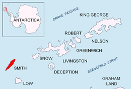
Location of Smith Island in the South Shetland Islands |
|

Location of Lenoir Rock 
Lenoir Rock (South Shetland Islands) |
|
| Geography | |
|---|---|
| Location | Antarctica |
| Coordinates | |
| Archipelago | South Shetland Islands |
| Area | 1.29 ha (3.2 acres) |
| Length | 230 m (750 ft) |
| Width | 85 m (279 ft) |
| Administration | |
| Administered under the Antarctic Treaty | |
| Demographics | |
| Population | uninhabited |

Lenoir Rock (Bulgarian: скала Леноар, romanized: skala Lenoir, IPA: [skɐˈla lɛnoˈɐr]) is the rock off the NW coast of Smith Island in the South Shetland Islands, Antarctica 230 m long in southwest-northeast direction and 85 m wide with a surface area of 1.29 ha. The vicinity was visited by early 19th century sealers.[1]
The feature is named after Étienne Lenoir (1744-1832), a French scientific instrument maker and inventor of the repeating circle; in association with other names in the area deriving from the early development or use of geodetic instruments and methods.
Location[edit]
Lenoir Rock is located at 62°56′54″S 62°33′04″W / 62.94833°S 62.55111°WCoordinates: 62°56′54″S 62°33′04″W / 62.94833°S 62.55111°W,[2] which is 380 m southwest of Jireček Point and 1.85 km northeast of Villagra Point. Bulgarian mapping in 2009 and 2017.
See also[edit]
- L. Ivanov. Antarctica: Livingston Island and Greenwich, Robert, Snow and Smith Islands. Scale 1:120000 topographic map. Troyan: Manfred Wörner Foundation, 2010.
ISBN 978-954-92032-9-5 (First edition 2009. ISBN 978-954-92032-6-4)
- South Shetland Islands: Smith and Low Islands. Scale 1:150000 topographic map No. 13677. British Antarctic Survey, 2009
- L. Ivanov. Antarctica: Livingston Island and Smith Island. Scale 1:100000 topographic map. Manfred Wörner Foundation, 2017. ISBN 978-619-90008-3-0
- Antarctic Digital Database (ADD). Scale 1:250000 topographic map of Antarctica. Scientific Committee on Antarctic Research (SCAR). Since 1993, regularly upgraded and updated
References[edit]
External links[edit]
This article includes information from the Antarctic Place-names Commission of Bulgaria which is used with permission.
Recent Comments